

Maps
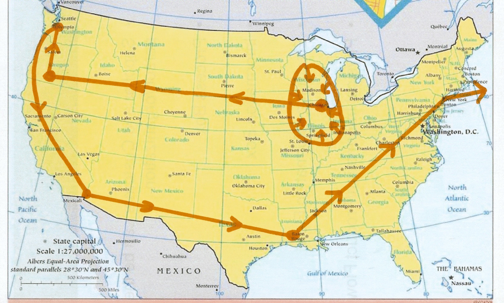
Below are four maps outlining the general movements of the 555th Heavy Ponton Battalion.
The first map shows battalion movements from Chicago to Camp White in Oregon, then to Fort Lewis in Washington. From there they moved to the desert along the California-Arizona border, and then on to Louisiana for the end of training prior to shipping overseas. The battalion shipped out of New York City.
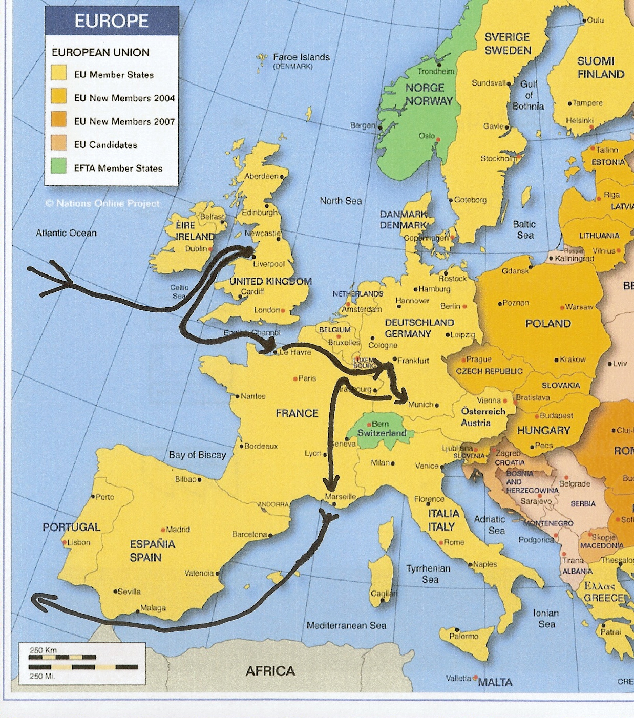
The second map is a high level overview of movement in Europe.
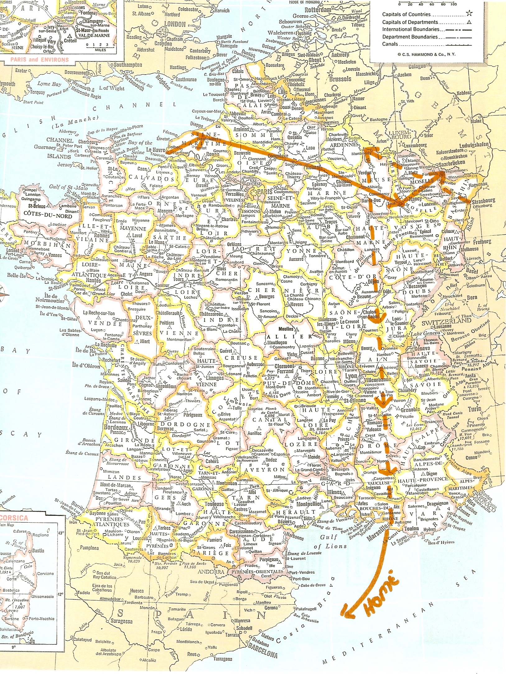
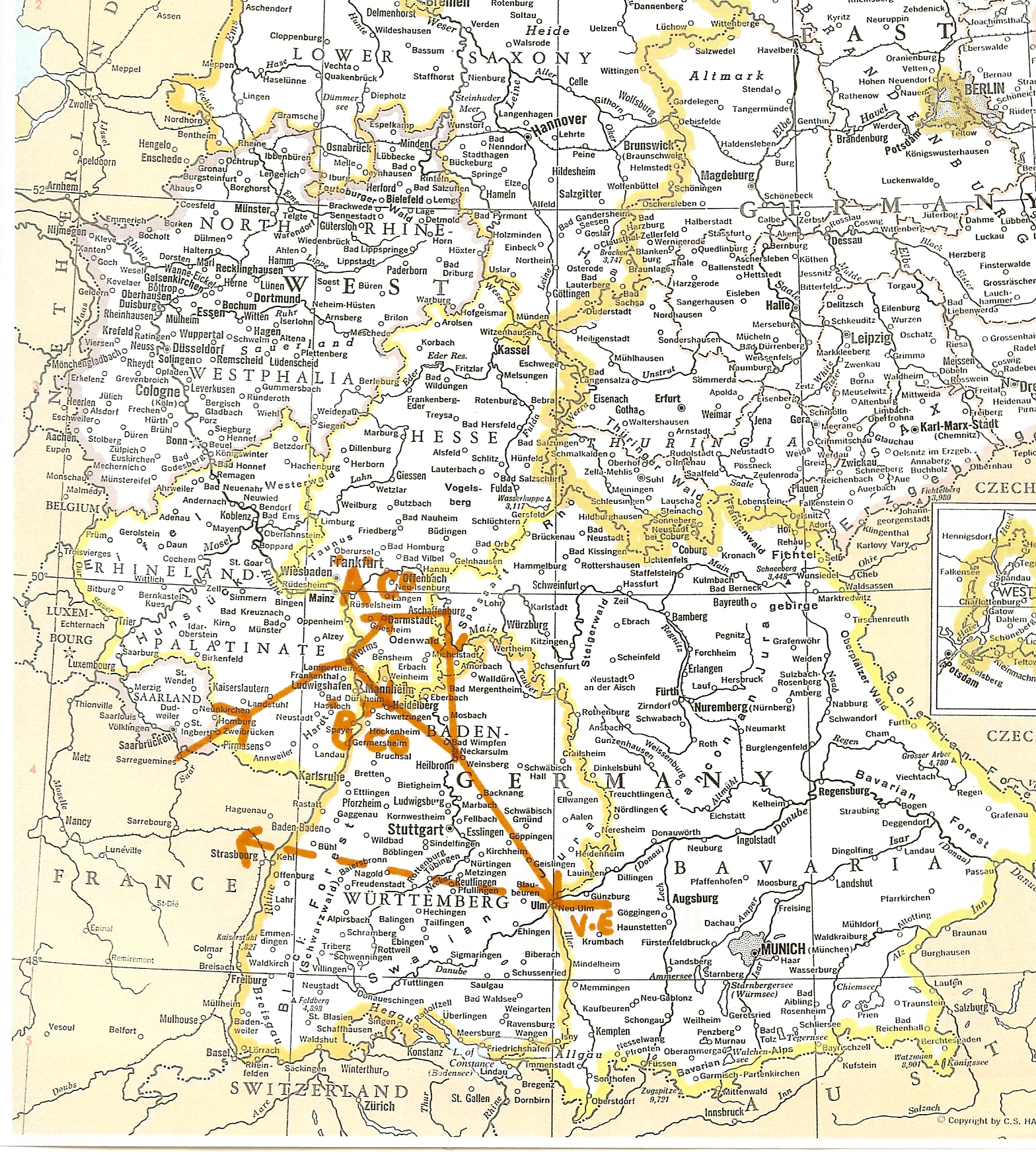
The third and fourth map trace battalion movements in both France and Germany (click to enlarge). Once in Germany the companies were split up and moved to several locations before meeting up again at Heilbronn.
The map shows the battalion changed direction abruptly from moving northeast towards Berlin to southeast towards Munich and the Austrian border. At this point in the War in Europe the allies had ceded the taking of Berlin to the Russians. Although controversial at the time this decision by General Eisenhower is generally accepted as correct by historians. The occupation of Berlin by the four main powers had already been agreed to, and the taking of Berlin would prove to cost the Russians over 300,000 casualities.
There was also a widely held belief that Adolf Hitler and the SS would make a final stand in the Bavarian Alps near Hitler’s mountaintop retreat at Berchtesgaden. This Nazi strategy influenced Eisenhower’s decision making as he moved U.S. forces in that direction. Fortunately this ‘Nazi redoubt’ never materialized as German resistance collapsed.